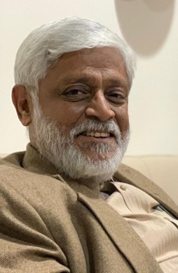

In Conversation with Prof. Amit Bose
This interview was conducted on November 7th of 2020.
Prof. Amit Bose, an educator, visionary, motivator, institution builder and an inspiration to many. He has done his architecture from University of Roorkee (now IIT Roorkee) in 1971-72. During his five decades of professional journey, he has worked on variety of projects including physical planning, healthcare planning and design, policy making, development planning, and disaster mitigation and management. He has worked in India and abroad and has been active in field of teaching. He is a visiting professor to many IITs, NITs and private Institutions.
Prof. Amit Bose, is currently Director of DDF Consultants Pvt Ltd, a leading research and consultancy organisation in Asia. DDF’s head office is located in New Delhi, India. It branches and liaison offices are in different parts of India, an overseas office in Dubai and Associate office in Australia. His organisation has won many international and national design competitions during last few years.
Prof. Amit Bose has been consultant to World Bank UNDP, many MNCs, State Governments and Public Sector Undertakings. Recently, Ministry of Urban Development, Government of India has conferred on him ‘Award of Excellence’ for preparation of comprehensive mobility plan (CMP) for Agartala, capital town of Tripura, India. Prof Bose has been associated with Planning Commission of India and Delhi Urban Arts Commission (DUAC) in various capacities.
Team at WOARCHITECT interviewed Architect and Planner Prof. Amit Bose to learn about his professional journey.
urban planning economic growth background scope united nations disaster management agencies advice
A: It is a pertinent question. Definition of planning has been changing since we started planning. Essentially, planning is a process. Through this process, we achieve the objectives of development—which is physical in nature. The planner, in this process, integrates economic development, social development, cultural development, environmental development, and historical and heritage development. Add to that, planners have to integrate the futurist technology that is expected to develop in the next twenty years or so. It is a culmination of integration of aforementioned developments.
Q: How are planners contributing to the economic growth of any city, region or country?
A: When India got independence in 1947, it took the lead in development through a planned process, and a planning commission was established. Now, the planned process in bigger than urban planning—its country wide. At the time, the focus of the planned process was the development of agriculture, and hence urban planning did not get the due importance in the first ten years of independence. Unfortunately, the urban planning process took a backseat.
In the early 50s, India was focused on agriculture, and urban development was not in the agenda, except Chandigarh and few other industrial towns. The ninety percent of the Indian population—which was rural—was contributing to eighty percent of the economy. The economic distribution was directly proportional to the population distribution. However, worldwide it is observed that the economic development is directly proportional to the industry and urban development. Indian planners took this observation and integrated economic development at the master plan level. Due to their efforts, today, thirty percent of urban Indian population produce more than seventy percent of Gross Domestic Product (GDP).
Today, India is the fourth largest economy in the world. In 1947, at the time of India’s independence, its economy was ranked lower than hundred. This progress was achieved through dedicated planning process. Given that India is a democratic society, it is quite a commendable progress. Urban planning contributed to the progress. Hence, urban planners need to realize the responsibility they have towards national economic development.
Q: How is architectural background helpful as an Urban Planner?
A: In my experience, often times I have noticed architects think they do not have the economic understanding to contribute to the urban planning process—I disagree. Architecture, itself is an economic process. Architects have to take immense care of cliental budget. For example, our firm has designed around twenty four medical colleges with identical architectural requirements, however, with varying budgets ranging from two hundred crore Indian Rupees to six hundred crore Indian Rupees. Such is the case with most architectural building typologies. Architects, in broad sense, take care of individual client economics, and planners deal with wider city and regional economics—the difference is scale.
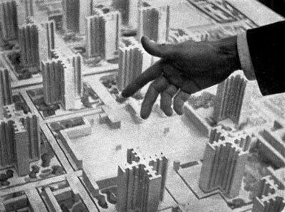
Secondly, Architects can visualize in three dimensions. Other professionals are not trained to do so. Usually, planners are often briefed with city development in terms of physical area. A town with three hundred square kilometers in 2021 is expected to grow up to five hundred square kilometers in 2041. This is a standard developmental approach in most developing countries. Why is this problematic? When city development is measured in terms of the horizontal expansion it requires laying of infrastructure to reach to the farthest point. The city has to lay water, sanitation, disposal, storm, water, electricity, and IT connectivity. Laying of infrastructure then becomes the costliest affair in any developmental process. The alternative approach is–ReDensification. The approach requires visualization and there are no other professionals trained in visualization better than architects. Equipped with the creative thinking, along with the will of extending and fine tuning their skills, architects have the potential to be great physical planners.
Q: How far are planners involved in large-scale development?
A: I got the opportunity to work at national level projects. Accordingly, I was consulting the government of Tripura, a state in northeast India. This was around eighteen years ago. Since I come from an architectural background, I had researched the area in multi-layers. Tripura is a land-locked state. More than ninety percent of the border is shared with Bangladesh (country adjacent to India) and less than ten percent of the state border is shared with lesser developed states of India.
The idea was that the state has to have connectivity to the mainland either with Bangladesh or India so that the state’s endowments can become resources when they are utilized for mass usage. One of such resources of Tripura is its pineapple production. One of the best species of pineapple in the world is available in Tripura, they are about 6 inches in size and sweet in taste. It was sold for fifty paisa or one rupee at that time, whereas in other states like Delhi or Kolkata, it was sold for ten to twelve rupees. The resource was being exploited. I suggested that the state should utilize its connectivity to the Bangladesh port and increase export of pineapple production. This idea initiated an agreement between India and Bangladesh and in the year 2020, Tripura exported its first consignment to the Bangladesh port. The route has the potential to become an international gateway for all of northeast India. Example of Tripura is an excellent testimony of large scale involvement of planners in decision-making.
Another example is of Nainital, a town in India’s Uttarakhand state. The major issue with Uttarakhand state is a lack of permanent capital–It has now named Dehradun (town northwest of Nainital) as its temporary capital. Thereafter, they decided to make Nainital as the high court city. This decision has ruined the city. Nainital, for the longest time, was a major tourist city of India. Due to the afromentioned decision, it has now become a litigation city. This attracted a different kind of population to the city as opposed to the former tourist population. In India, one litigate involved in any high court case, brings along with him/her four to five people (a common sub-culture trait), the city was not equipped to cater to the influx. Naturally, low end activities started erupting in this city. Thereby, there is overcrowding and deterioration of influx of quality tourist in Nainital. I noticed the dying city of Nainital, and put forth a suggestion to the government, urging them to take immediate steps to mitigate the issue. Due to my initiative, we now have a master plan in place for Nainital that careful examines the issue and proposes a solution through multi-nodes development.
These two examples tell us that initiatives and skills of architect-planners can greatly influence decision making at city, regional and international levels, it is almost equivalent to receiving a life- time achievement award.
Q: What role does United Nations play in influencing the planning processes and how did you navigate challenges (if any) of such influence?
A: United Nations (UN) has an organization under it called ‘UN-habitat’, along with other sub-organizations such as UNICEF. United Nations (UN) members from different nations discuss global planning outlooks through UN-Habitat conference. These discussions actively and/or passively affect the urban planning at city, state and regional level.
In 2016, during one of the UN-Habitat conferences, some important decisions were made. One of those decisions, especially for developing countries, was to expand cities horizontally. Thereby, suggesting that the hinder land, and the agricultural land is to be converted to non-agricultural activities. This is of course a non-sustainable outlook and makes us ask important questions like, ‘How far should we expand?’ or ‘Where does the city end?’ Surely, we cannot continue to expand endlessly. With the technological assistance at our disposal, could we not think of going vertical in lieu of horizontal expansion? Japan has done it, despite being in a highly vulnerable seismic zone. China has done it, despite being a Himalayan state country. However, most chief planners in India cannot think in terms of verticality.
Our firm was working on the master plan for Ranchi (city in the Indian state of Jharkhand). The typical brief by the city, as expected, was to expand the present town from seventy five square kilometres to seven fifty square kilometres by 2041. I was of a different thought process, and proposed to keep the city limits within fifty square kilometres and develop vertically. However, due to the mind-set of the authorities, I could not convince them—horizontality increases development cost by many folds. Here, the economic cost of the development needs to be re-evaluated. Horizontality requires massive expansion of city infrastructure. Add to that, as you move along the periphery, the city’s perimeter length increases, thereby increasing per unit population cost. For further illustration, consider the example of ring roads (a peripheral road along the boundary of a city). Having a ring road—which would be required for efficient connectivity—of twelve hundred square kilometres versus having a ring road of four hundred square kilometres makes the developmental cost differ 6-8 times. To change this mind-set, we require professionals who can think in three dimensions—hence being an architect-planner becomes crucial.
Q: Planning is not only about growth but it is also about managing and saving our cities from natural disasters/calamities. You have been very active in the field of disaster management, please tell us what your guiding principles are.
A: This is an area, often times, where planners don’t pay much attention. I am very fortunate that my wife—Dr Prathiba Bose—is an internationally renowned earthquake engineer. We often find ourselves arguing about the interpretation of disaster management. Since we come from different backgrounds, our interpretations differ and there is argument, tooth and nail! These arguments have inspired my contribution in the field. I have two major guiding principles, one is involving architects in the process, and second is understanding the quality of land.
Involving architects: In 1991, earth quake engineering was only taught at IIT Roorkee, my alma mater. Dr Jai Krishna—Padma Bhushan awardee (third-highest civilian award in India)—was the one who brought the earthquake mitigation technology to India through Japan and the USA. During my architecture education at IIT Roorkee, I was his student and he was serving as the head of department at that time. All the earthquake reporting at national level was conducted by the IIT Rourke team and they would submit official reporting to the Government of India (GOI). My wife—Dr Prathiba Bose—was part of that team. Through her, I was privileged to read the reports. I disagreed with couple of points. She dismissed my discernment stating that it is not the expertise of my field. Consequently, I discussed the issue with Dr Jai Krishna and he dismissed my concerns as well. His statement was, ‘architects should not enter this field’. Thereafter, I sought an appointment with the vice chancellor of IIT Roorkee. He was kind enough to let me voice my opinions. I explained him in brief, without the details of technicality, about my disagreement with some of the earthquake reporting done by the IIT Roorkee team. During the final signing of the earthquake reporting—which was to be done by the vice chancellor—he called me in his office along with the earthquake reporting team. He urged me to explain my concerns to the team. I explained them that the major issue was the fault of architects, because of their lack of understanding, the buildings collapsed. This changed the entire approach of reporting. At that time, it was a revelation for the team, and I got a little pat on my back from the vice chancellor. This was my first attempt at involving architects in the process of disaster management and physical planning.
The second instance is from the time of my involvement at the National Project for Earthquake Engineering Education. For the discussion of the project, and following the Gujarat earthquake in 2001, a conference was held at IIT Delhi. Since I was part of the project, I had been invited to the same. All the IITs of India had come together to initiate education and training in earthquake engineering for engineers—there was no mention of architects. I raised my concerns in the conference. I sternly put across that the nation cannot think of disaster management without considering architects and planners. I forced them to include the role and responsibilities of architects in the memorandum-even though only through a footnote, nonetheless included.
Understanding the quality of land: When the National Disaster Management committee was formed, I was the core advisor on the committee. One of our task as committee advisors was to integrate disaster mitigation in urban planning through physical planning process. Here, understanding quality of land becomes crucial-I am only discussing with regards to earthquakes since that is my area of expertise. Often times, planners tend to ignore the crucial aspects of analysing the quality of land. Today, we have tools available at our disposal to evaluate the quality of land, one of such tools is known as ‘microzonation’. Delhi, a city in north India, would have been designed completely different if the technology of microzonation was known to the physical planners. Due to the lack of microzonation, today many areas of Delhi are sitting on highly vulnerable land.
Another example is of Dhanbad city (second-most populated city in the Indian state of Jharkhand). Our firm was tasked for the master planning of the same. Our brief was to tackle areas of discarded coal mines. The area of discarded coal mines is highly vulnerable. We decided to zone it as ‘open area’. Our decision was questioned by a member of Urban Local Body (ULB) of the Dhanbad City, he was stumped that we were ‘leaving’ this area or not utilizing its potential. The potential of the area lies in the management of disaster and not development. The knowledge of land quality is crucial to understand the difference. In my career span, I had difficulties getting physical planners to understand the importance of microzonation and evaluation of land quality. However, lately I see some progression in the direction.
Q: What other professional agencies do planners interact with?
A: Social planners, economic planners, infrastructure planners, environmental planners, disaster managers and physical planners form the core planning team. Planners interacts with geographers, economist, sociologist, and community members. As planners, at times, one must also interact with administration officers, members of parliament and assemblies, and elected officials.
Q: What advice do you have for young architect who wants to pursue the field of urban planning?
A: As an architect, when you are thinking of becoming an urban planner, your outlook increases. One begins to expand his/her creativity from a building to the city to the region to the country. This is a big gain. Architects, with their creative thinking, vision and background can make excellent planners. However, I advise young architects to first get two or three years of work experience as architects and only then proceed to urban planning. You ought to get the exposure and skills of professional architect to hone your creative thinking that could be utilized in urban planning. Otherwise, you might not able to fully utilize your architectural background to assist you in your urban planning profession.
We would like to thank Prof. Amit Bose for the interview, to listen to the full-length interview, follow this link: https://www.woarchitect.com/#post-15

